
EXPERIENCING DRAINING ISSUES OR FLOODING?
PROJECT 03
CITY OF EL DORADO
Project Area:
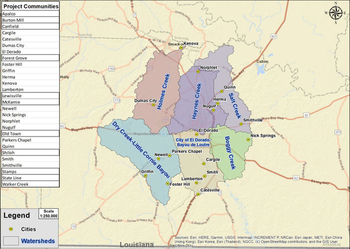
Haynes Creek Watershed (HUC 080402010407)
Salt Creek Watershed (HUC 080402010408)
Boggy Creek Watershed (HUC 080402020501)
City of El Dorado-Bayou de Loutre Watershed (HUC 080402020502)
Dry Creek-Little Cornie Bayou Watershed (HUC 080402060302)
Holmes Creek Watershed (HUC 080402010405)
Communities located within the project area:
Cargile, Dumas City, Foster Hill, Herma, Kenova, Newell, Nick Springs, Norphlet, Nugulf, Quinn, Smith, Smithville, Catesville, Griffin, Lamberton, Parkers Chapel, El Dorado
Watershed Improvement: Project Options Review
Tuesday, July 30, 2024 | 5 p.m.
City Hall, 204 N West Ave, El Dorado, AR 71730
Development Status

Study Area
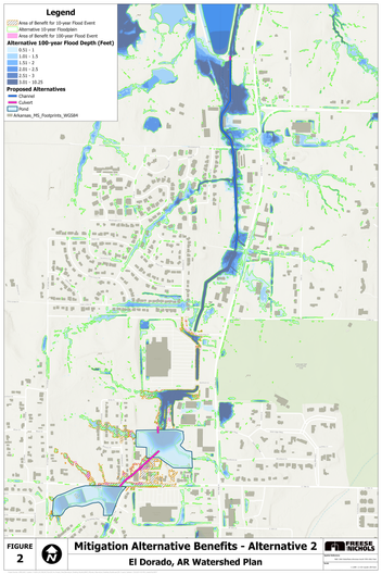
These maps show the project area. Click on each map to view a larger image. Maps showing additional study information are included in the "Additional Project Information" section below.
Additional Project Information
The following materials include background information about the project, progress updates recently shared with communities in the project area and project maps. Future updates will be added as new information becomes available.
Flood Prone Locations
Project Consultants


